







Enabling customers to reduce their environmental impact | Read how X
HEXAGON

EXPLORE HEXAGON

HEXAGON'S DIVISIONS

Hexagon OVERVIEW

OUR STORY

Hexagon Live

SOLUTIONS

Learn More
Hexagon Spot Light

SUSTAINABILITY

Learn More
Hexagon Local

HxGN SPOTLIGHT

Learn More

HEXAGON'S DIVISIONS

Hexagon Agriculture

Agriculture

Hexagon Agriculture
Intergraph PP&M

ASSET LIFECYCLE INTELLIGENCE

Hexagon Positioning

AUTONOMY & POSITIONING

Hexagon Geosystems

Geosystems

Hexagon Geosystems
Hexagon Metrology

Manufacturing Intelligence

Hexagon Mining

Mining

Intergraph SG&I

SAFETY, INFRASTRUCTURE & GEOSPATIAL

XALT SOLUTIONS

XALT SOLUTIONS

  • HxGN Spotlight
  • Industry
    • Aerospace
    • Agriculture
    • Automotive
    • Buildings
    • Defence
    • Education and research
    • Government
    • Infrastructure
    • General manufacturing
    • Marine positioning
    • Medical
    • Mining
    • Oil and gas
    • Energy and power generation
    • Public safety
    • Surveying
    • Transportation
    • Utilities and communications
  • Channel
    • HxGN Blog
    • HxGN TV
    • HxGN Radio
  • Topic
    • Innovation
    • Sustainability
    • Thought Leadership
    • Acquisitions
    • HxGN LIVE
  • Division
    • Agriculture
    • Asset Lifecycle Intelligence
    • Autonomy & Positioning
    • Geosystems
    • Manufacturing Intelligence
    • Mining
    • Safety Infrastructure & Geospatial
  • About HxGN Spotlight
  • Hexagon.com
  • Industry
    • Aerospace
    • Agriculture
    • Automotive
    • Buildings
    • Defence
    • Education and research
    • Government
    • Infrastructure
    • General manufacturing
    • Marine positioning
    • Medical
    • Mining
    • Oil and gas
    • Energy and power generation
    • Public safety
    • Surveying
    • Transportation
    • Utilities and communications
  • Channel
    • HxGN Blog
    • HxGN TV
    • HxGN Radio
  • Topic
    • Innovation
    • Sustainability
    • Thought Leadership
    • Acquisitions
    • HxGN LIVE
  • Division
    • Agriculture
    • Asset Lifecycle Intelligence
    • Autonomy & Positioning
    • Geosystems
    • Manufacturing Intelligence
    • Mining
    • Safety Infrastructure & Geospatial
  • About HxGN Spotlight
  • Hexagon.com
HxGN SPOTLIGHT >Safety Infrastructure & Geospatial (Page 16)

Sort by options below:

Topic
Industry
Channel
Date Range
HxGN TV
HxGN TVVideo
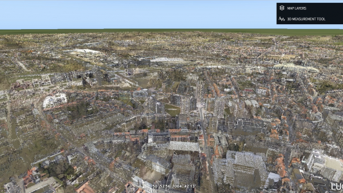
Unlimited Point Clouds in LuciadRIA

This demo shows LuciadFusion and LuciadRIA handling unlimited point clouds. Since V2018 LuciadFusion can stream…

Read More
Featured Technologies|Innovation|Government 21 February 2019
HxGN TV
HxGN TVVideo
What Makes a City Safe? People, Process & Technology.

In this HxGN TV episode, Jim Dobbs, director of Global Communications for Hexagon’s Safety &…

Read More
Innovation|Tech Trends|Thought Leadership|Public safety 15 February 2019
Blog
HxGN BlogBlog
Better Data Visualization and Analytics Tools Improve Decision Making for Public Safety Agencies

For today’s public safety agencies, turning the data deluge into actionable information has become difficult without the right tools. In this post, Jack Williams discusses how Intergraph InSight helps agencies see and leverage their data in new ways.

Read More
Featured Technologies|Innovation|Thought Leadership|Public safety 30 January 2019
HxGN TV
HxGN TVVideo
How to Turn Public Safety Data into Insight

Out-of-the-box data visualization and reporting for public safety agencies

Read More
Featured Technologies|Innovation|Public safety 23 January 2019
HxGN TV
HxGN TVVideo
How North West Fire Control Realizes Efficiencies and Cost-Savings with Shared Services

Mandy Liffen from North West Fire Control discusses how the agency integrated multiple communications and dispatching systems into a central control center that handles all emergency calls and mobilizes fire and rescue services for more than 5.5 million people.
Read More
Innovation|Success Stories|Public safety 17 December 2018
HxGN TV
HxGN TVVideo
Delivering Customized Location Intelligence

Irmi Runkel, Managing Director from Geosystems GmbH, discusses the importance of reliable data. Learn how ERDAS IMAGINE Spatial Modeler is used to automatically detect and remove problem areas from data for accurate business intelligence.

Read More
Innovation|Success Stories|Agriculture|Defence|Government|Infrastructure|Transportation 17 December 2018
<<< 1 … 14 15 16 17 18 … 42 >>>

HEXAGON © 2026

  • Privacy Policy
  • Terms Of Use
  • About
  • Contact Us
  • Hexagon on Facebook
  • Hexagon on Instagram
  • Hexagon on LinkedIn
  • Hexagon on Twitter
  • Hexagon on Youtube