










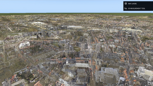
This demo shows LuciadFusion and LuciadRIA handling unlimited point clouds. Since V2018 LuciadFusion can stream…

LISTECH Neo is new generation geospatial software for surveyors, offering exciting functionality with increased productivity and ease of use. Neo offers the ability to tailor attributes to suit client needs.
For today’s public safety agencies, turning the data deluge into actionable information has become difficult without the right tools. In this post, Jack Williams discusses how Intergraph InSight helps agencies see and leverage their data in new ways.
Marc Melviez with Hexagon’s Geospatial division discusses the wide-reaching impacts of sensor technology, software and the future of AI in the aviation industry.
FieldGenius surveying app users have reported up to a 30 per cent reduction in the time it takes them to complete a job because of the advantages it offers.
Out-of-the-box data visualization and reporting for public safety agencies