


For a few years now, the world seemingly keeps sliding into disorder. Events such as the global pandemic, severe weather events, the war in Ukraine and the resulting threat to our energy supply lead to discontinuous developments that make information from the past irrelevant for predictions of the future. To devise effective strategies to counteract disorder, we must first ask: What are the important issues? Which ones do we focus on? And what is possible, now and in the future, to address them?
In a future full of uncertainty, it’s the powerful use of technology empowering data to create more than a digital twin. Around the world, Hexagon’s expertise in reality capture, positioning, design & simulation, location intelligence and autonomous technologies are working together to deliver Smart Digital Realities™ for customers across Germany and around the globe.
The certainty of uncertainty
Whether it is transitioning into a climate-friendly, carbon-neutral country or ensuring the functioning of society in times of pandemics, digitalised methods and processes are essential tools for tackling complex challenges. In manufacturing, Digital Twins and simulations are already indispensable for understanding intricate issues and preventing errors. Digitisation has led to new standards of quality and shorter response times. By making mistakes in the digital world, you prevent them in the real world. Combining Digital Twins with specialised data enables stakeholders to make the best decisions after weighing all the possibilities.
Fortunately, today we know that creating a Digital Twin of all of Germany is feasible — and within reach. One important milestone has been the pilot project between Hexagon, the Federal Agency for Cartography and Geodesy, the State Office for Geoinformation and Surveying of the Free and Hanseatic City of Hamburg and the Hamburg Metropolitan area. Hexagon created a Digital Twin of Hamburg covering a surface area of 8,650 square kilometres in 89 flight hours. The data acquisition was carried out with Hexagon’s latest technology, a single photon LiDAR sensor. The result is a three-dimensional model of the entire surface area, in which all relevant objects are recognisable: buildings, rooftops, power lines, trees, bushes, surfaces underneath vegetation and water surfaces, and even areas up to five to ten meters below the water surface. Every square meter was captured with a point density of at least 42 points per square meter and a height accuracy of well under ten centimetres. At the same time, aerial photographs with a resolution of 22 centimetres were taken. The successful completion of the Hamburg project shows that, depending on weather conditions and the number of LiDAR aircraft used, a Digital Twin of the entire country can be generated in less than 24 months. With some practice, the survey can be repeated every year. This would result in a consistent Digital Twin of Germany across all federal states. The resulting data is ten times more detailed than what most federal states currently collect. And it is more current than the data sets federal states currently use which have been collected in stages and are up to twelve years old.
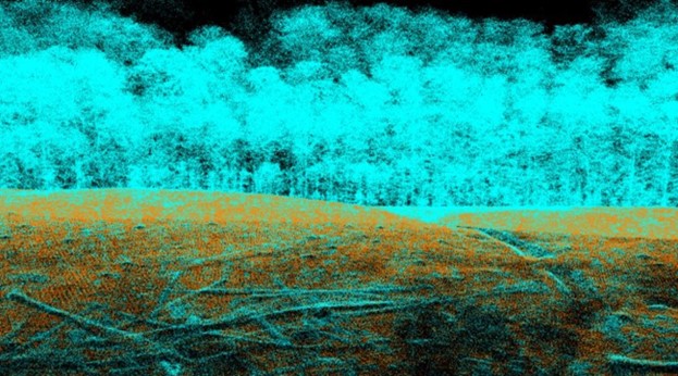
Cross section image of LiDAR
Data-enriched Smart Digital Realities facilitate decision making
The more data we can capture and quantify, the more accurate our basis for decision making. Artificial Intelligence (AI) now enables us to automatically label common objects, such as rooftops, high-voltage power lines and vegetation. AI also helps us develop analytical models to make predictions based on past patterns. For example, one such analytical model may tell us when to intervene to prevent vegetation from growing too close to power lines.
Another application is the simulation of floods. Scientists predict that heavy rainfall will be up to 19% more intense and up to nine times more frequent in Western Europe due to climate change. With the help of algorithms, we can now predict how much and where water will spread in case of heavy rainfall, enabling us to take precautionary measures to protect the population and infrastructure.
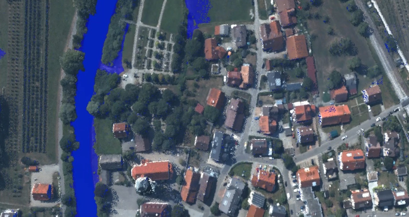
Flood models through Smart Digital Realities
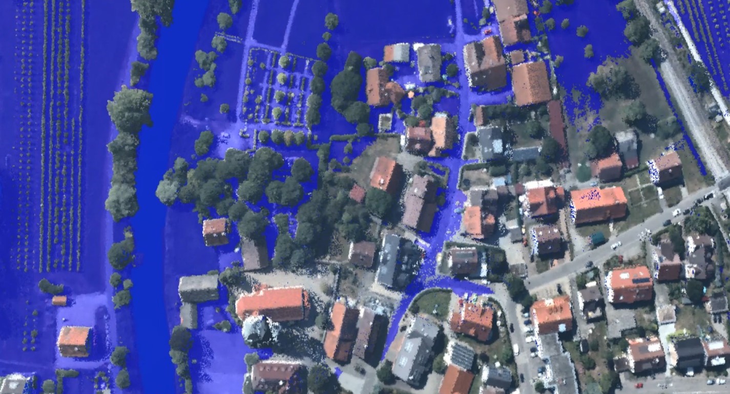
Flood models through Smart Digital Realities
Technology is ready
Digital Twin models capture every single tree and allow us to create a digital green space inventory for Germany. Currently, a forest is defined as “an area planted with forest plants.” The area may include all kinds of tree-free spaces, including paths, wood storage areas and safety strips. Instead, we should monitor green spaces everywhere with much more specificity: Why not populate a tree cadastre with its biomass? We can measure all the trees, not only in forest areas but also in urban spaces. Regular updating of the models will enable tracking and progress monitoring, and thus provide us with the information needed to preserve and increase the tree population crucial for carbon sequestration.
Colourised point cloud of Hamburg
To meet EU renewable energy targets, the European Commission has proposed a solar rooftop requirement for commercial and public buildings from 2027, and for new residential buildings from 2029. A Digital Twin capturing all of Germany’s over 50 million rooftops will assist Germany in realising these ambitious goals: Within the country’s 3D model, AI can highlight the rooftops that do not yet have solar-paneled roofs and calculate their solar potential.
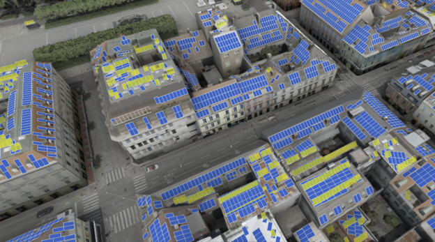
Solar potential
You could also, for example, test the suitability of various locations for wind farms. In the Digital Twin, you can assess from where the windmills would be visible and measure their noise impact. The highly detailed Digital Twin models allow you to take all acoustic variables into account, such as the fact that forests absorb more sound than open space. These comprehensive wind turbine simulations can speed up the planning and approval processes and improve communication with stakeholders.
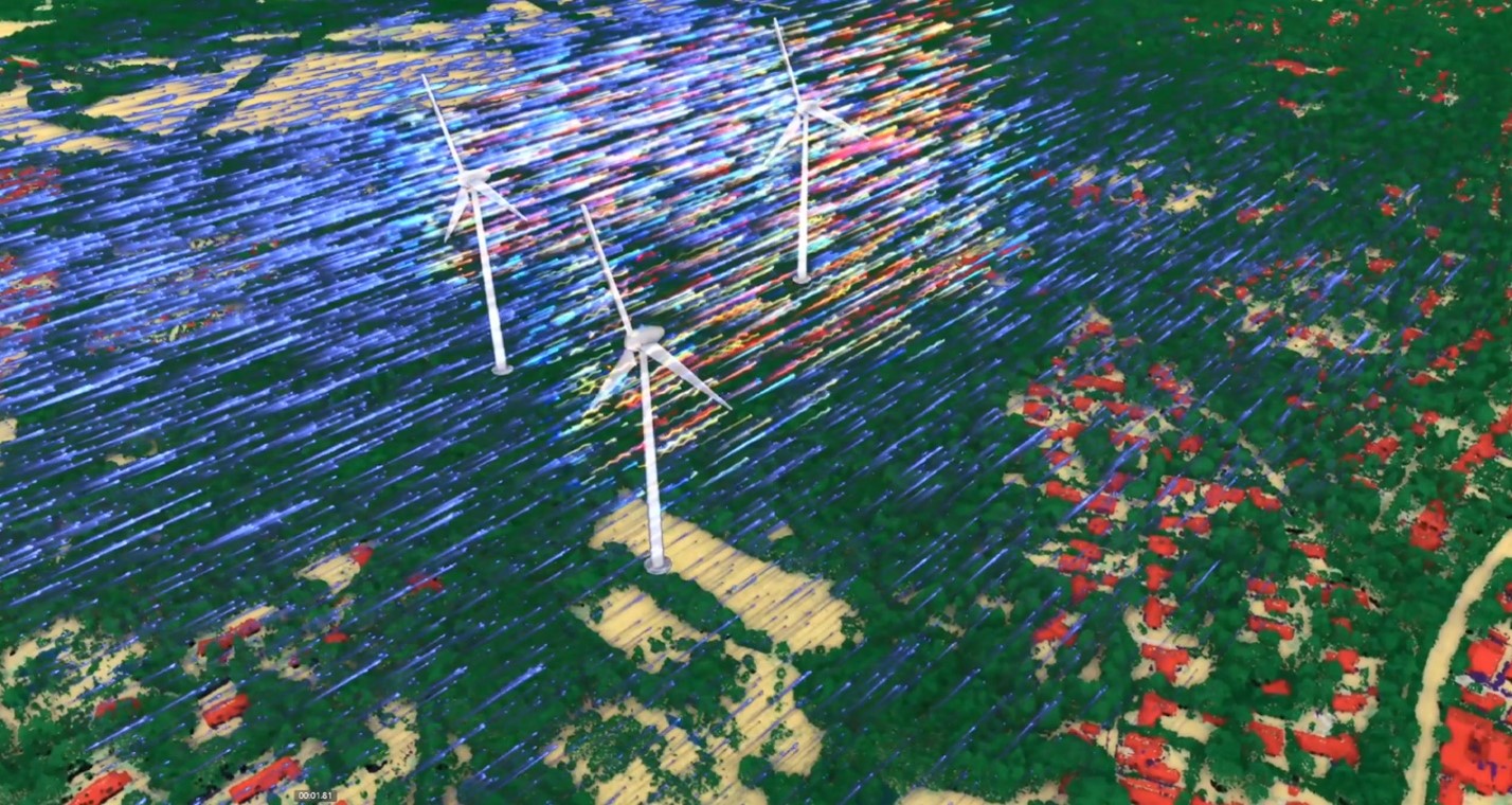
Simulation of windmills in classified point cloud
What is next?
Tackling a few specific projects will help us demonstrate the technology’s potential and pave the way for future applications. We are just at the beginning of a technological transformation that is rapidly changing the way we work and make decisions.
Through real-time data capture and analyses, it is the Smart Digital Reality that will transform the digital twin to provide a 360-degree picture of actual and simulated solutions to improve productivity, quality, safety and profitability. Let me make three predictions as to where the technology is heading in the next five years.
First, the Digital Twin will be enriched extensively with real-time data. Thanks to miniaturised sensors, faster communication technologies, and combined edge and cloud computing, autonomous drones will be able to create Digital Twins in real time — perhaps not in every city, but in a few pioneering ones. Critical infrastructure protection is one important application for real-time, data-enriched Digital Twins. That is a Smart Digital Reality – when technologies create intelligent digital reality solutions that fuse physical and digital realms and deliver actionable intelligence to support scenario planning, situational analysis and accurate, real-time decision-making. The ability to monitor critical infrastructure through augmented reality in real-time will allow security personnel to detect potential defects or sabotage early and act accordingly.
Second, Digital Twins will deliver a more real-life-like experience due to rapidly increasing processing and visualisation capacities. Fusing aerial imagery with street-level and terrestrial data will allow for a more immersive representation of complex urban space. Merging digital models of the interior of buildings with digital models of their exterior puts everything in context. Meanwhile, a continuous data stream supplied by sensors mounted on driving vehicles can keep these 3D representations up to date.
Third, the physical and the digital worlds will become increasingly seamless, and we will engage with it more actively and directly. City planners will do wind simulations before approving new buildings to understand their impact on the city’s climate. Enhanced simulation technology will change the way employees are trained, enabling train drivers, for example, to practice safety scenarios in digital space. Music aficionados, meanwhile, can attend concerts held at far-flung locations through their virtual avatar.
And that is where the metaverse comes into play: The geospatial industries are set to play a significant role in the development of the metaverse, the part of the metaverse where the real world matters and virtual worlds are not enough. Our Digital Twins will not only support land management processes but also become an integral part of a metaverse blending reality with digital experiences with Smart Digital Reality solutions that are rooted in reality, infused with hyperconnected data and create fully autonomous systems.


