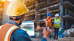
Debunking the biggest myths in a complex industry in this episode of HxGN RADIO.
Welcome to HxGN Radio. This is your host, Monica Millers Rodgers. Today’s podcast is brought to you by Leica Geosystems. Revolutionizing the world of measurement and survey for nearly 200 years, Leica Geosystems creates complete reality capture solutions for professionals across the planet. Known for premium products in innovative solution development, professionals in a diverse mix of industries trust Leica Geosystems for all their geospatial needs. With precise and accurate instruments, sophisticated software and trusted services, Leica Geosystems delivers value every day to those shaping the future of our world.
In today’s episode, we are talking about some of the most common misconceptions in the building construction with Bernd Moeller who is the program manager for building construction at Leica Geosystems.
MM: Bernd, thank you so much for joining us today.
BM: Thanks for having me here.
MM: So Bernd, you are the program manager at Leica Geosystems for building construction. What does that entail?
BM: Yes, that’s correct. That means that I’m following a couple of different roles at the moment. One is called internally a kind of product shaper, and that means that I’m in charge of building a link to the customers to the construction industry. I’m trying to constantly get the trends and feel the pulse of the time of the industry to feedback that information to our R&D teams to make sure they understand the requirements of our customers. Before that actually, I did work for our machine control portion of the business, but the last 9 years, I’m working now for the building construction industry. On top of that, I’m in charge of our iCON robotic total station and menu total station and our very famous iCON build for construction layout.
MM: Well, you certainly have some deep experience in this field. In these years of working in this industry, what have you come across as the most common myths in building construction?
BM: There is a couple that we can explore now a bit. I would say the first myth in this building industry is that it’s all about BIM or3D models. Obviously, there is a bit of a secret here. What I would like to explore are the different personas which work in this segment. There are many, and each of them are in need for plans to either design or manage or construct or maintain from these plans. So now that BIM as a process to bring these personas together, becomes so dominant in this industry, there’s actually a risk to forget those personas that aren’t yet exposed to BIM as a process. So, the vast majority on construction sites is working a lot from typical 2D paper plans. That means that most contractors still use tapes, strings, plumb bobs to still transport a plan into the reality on site to construct from. There’s a difference between customers that need to verify a design, and the other part which needs to construct from a design. The group one adopts BIM heavily at the moment and the group two will soon have to follow. At Leica Geosystems iCON solutions for construction layout and reality capturing already work actually for both groups.
MM: That’s quite a balancing act with these two different groups. The ones that have already adopted BIM and the ones that are on the road to do so. BIM is still a very important aspect of the industry, so what else do we need to know about that?
BM: That leads me to the second myth in this industry. That would be the digitization of the site is not really important, which obviously is not true. The trend clearly is to digitally connect all the personas we’ve touched on earlier that are involved in this BIM process chain. The big construction companies globally, they all consider BIM adoption right now. So the major driver is to aim for minimizing project risks at an early stage of the project obviously to keep costs under control. Digital modeling already for the bidding estimation and pre-design phase and also continuously using the same data source with more detailed models and the design construction maintenance phase sounds good, but to utilize BIM to its full extent, digitalization needs to happen at actually every process step linked to the physical construction site. Getting as accurate as possible data as base for the estimation reduces guessing. Matching a new design to existing structures needs precise as-built data. Construction as per design requires simple to use layout tools to transport the model and its major data to the field and maintenance without knowing locations of assets and facilities is basically like flying blind. So Leica Geosystems positioning and measurement technologies, here nicely allows generating and transporting such digital data between the office and the site in order to digitize the complete process chain.
MM: Absolutely. So digitizing is very important out on any site, really. That also requires robotic total stations. Now, I understand that there are some misconceptions around those as well on the site. What do you know about that Bernd?
BM: Yes, we often feel and we often experience that a lot of contractors actually fear that robotic total stations are very complicated. So it’s a bit like they are scary to them and that has four areas. So often the contractors believe that using total stations requires specific professional education which they obviously don’t have on site. That it would dramatically change the way they are used to working so that often is a bit of a problem. Setting up a total station is very complicated. The last point is that it’s only for 3D data and obviously that’s not really the case. Our iCON total stations are designed with the contractor in mind. Average training of customers to get productive, has shown that it takes only 15-30 minutes to get them productive no matter what background that these customers have. Our aim is to help contractors in the digitalization of the construction site. The customer group that is still working with tapes and strings as I have explored before is used to read line and offset dimensions from a 2D paper plan and put it in place with tapes, error-prone right angle methods and chalk line for instance. Our solutions imbed exactly in this process. Just that we replaced the error sources and increase efficiency at the same time. This works for 2D paper plans, but is also ready up to 3D design models from BIM authoring tools such as Revit or Nemetschek. Our patented world’s first setup pilot function even automates the setting up process via the press of just one button. So, physically for a contractor or a foreman on site it’s an absolute easy process to do and carry out.
MM: Absolutely, and that makes digitilization of the construction industry even easier. So it’s exciting to see where we’re going to go in this industry. Thank you so much for coming today and sharing your insights with us.
BM: You’re welcome. Thanks for having me here.
For our listeners, you can learn more about building construction at Leica-Geosystems.com. Tune in to more episodes from HxGN Radio on ITunes, Soundcloud, or Stitcher radio. Thank you for listening.


![[PODCAST]: Clarifying Myths in Building Construction](https://blog.hexagon.com/wp-content/uploads/2016/08/artworks-000174332355-rawblt-t500x500-500x391.jpg)


